 We then drove to Windlass Hill. It was the steepest decent the wagons had encountered so far on the trail. It was quite a hike just walking up the path.
 Our RV is way down at the bottom,(left side) you can hardly see it. Can you imagine taking a wagon down this hill?
 After the wagons went down Windlass Hill they came to Ash Hollow.
 Larry going into the visitors center at Ash Hollow. Notice we are now in Mountain Time.
 Are we sure this is the road to the campground ???
 After 3 miles the Wagon Train Campground appeared. We spent two days here and it improved by the minute.
 Our meal that night was a delicious rib eye steak dinner cooked on the grill.
 From the campground you could see Chimney Rock. It was a landmark along the trail for the wagons and is on the Nebraska state quarter. Notice the warning sign.
 On Monday we took a three hour wagon ride out to Chimney Rock. Each of us got the opportunity to drive the wagon. Our wagon master has been doing tours for 37 years, had lots of stories and was quite a character . A true old time cowboy.
Lynda was first to take the reins.
 Ellen being shown the way.
 Now it was Carol's turn. We drove down dirt roads over railroad tracks, across route 92, and through pastures with cattle. It was a pretty bumpy ride and even with sitting on pillows our bottoms were ready to get out. He always started the horses with wagon ho and we all would lose our balance as the wagon jerked forward.
 Then we had to hike to go around to the other side of Chimney Rock. Not many people get to see it from here.
 A marker honoring the man who gave this land to the state.
Now we have to go back down, a little easier then going up. See the horse and wagon waiting for us.
 A group picture when we were all safely back down.
On Tuesday Lynda and I took a long ride all around the area while Larry played golf. We saw Courthouse Rock another landmark.
 Wednesday we stopped at Scott Bluff National Park. The last time Larry and I were here we walked the 1.6 mile trail up to the top, but this time we drove up.

 All through Kansas and Nebraska we have followed the railroad and now that we enter Wyoming it is no different. We spent two days in Guernsey State Park and our camp site was very close to the tracks. The trains are about 150 cars long all filled with coal.
 Our first stop on Tuesday, Aug 10, was to these amazing ruts.

 We then went to Register cliff where the pioneers had carved their names. Larry and I had put our initials there 5 years ago but we couldn't find them this time.
 We had a cookout at our site at Guernsey state park. We had no water or electric here so the rest of the group is camping in town at the Larson golf course where they have hook up. The weather has been very hot so air conditioning was needed. Our generator got quite a work out.
And yes, Larry played another game of golf at the golf course.
 Wednesday we went to Fort Laramie and had a very interesting guided tour by one of the rangers.
The Officers Quarters
 Our ranger showing us the bakery where they made 700 loaves of bread a day. There were two huge ovens and it would have been a very hot job in the summer. It wasn't good duty to have.
They actually were guarded so they wouldn't leave or take any of the yeast and use it for making brew.

The discovery of gold lead to lots of problems, especially for the Plain tribes.
 Fort Laramie Bridge, Larry was amazed with its construction in 1850's.
  Thursday, Aug 12 we were in Casper,WY. We went to the National Historic Trails Interpretive Center. Lynda is taking a simulated crossing of the North Platte River, not half as exciting as our real wagon ride.
In another part of the interpretive center Lynda tried her hand at pulling a Mormon handcart. She pulled too slowly to make it across the mountains in time.
 I was pulling a little faster but not for very long and would never make it either.
Friday on our way to Lander, WY we stopped at Independence Rock. The wagons were to pass here by July 4 to get through the mountains before winter storms.

Our group walking out to the rock.
 Emigrant signatures on top of the rock.
 Ellen and I climbed up to the top. The rest of the group took a mile and a quater walk around it.
 Fun looking at all the signatures and their date.
 A few miles down the road is the Morman Handcart Visitor Center. It was very well done explaining the Morman trail. They were Mormans who came by boat from England, then by train to Iowa where they were supplied with handcarts to make the rest of the 2,000 mile trip. It was very well organized with lots of support. Two parties left England way too late and it caused them to be caught in snow storms in this area. The only reason they all didn't die is because rescue parties were sent out from Salt Lake, 375 miles away. I am amazed so many of them survived.
 The center is maned by Morman volunteers. They do all the work at the center. We saw a lot of improvement since the last time we were here. They actually have camp for their youth to come and experience what it was like for their ancestors coming across this area.  Handcarts you can pull to Devil Gates, but we didn't choose to do it.
 Mountains ahead, even one with snow.
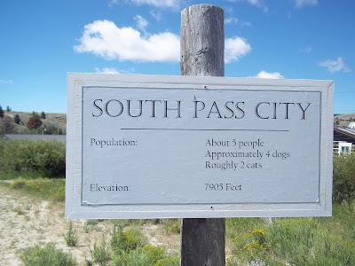
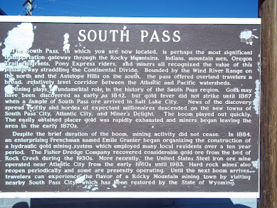
This is where we stayed on Friday and Saturday. The elevation is now over 5,000 feet. South Pass is the area the wagons crossed the Continental Divide, the only place that allowed an easy passage through the Rocky Mountains. We went to South Pass City an old mining town, today it is a ghost town.
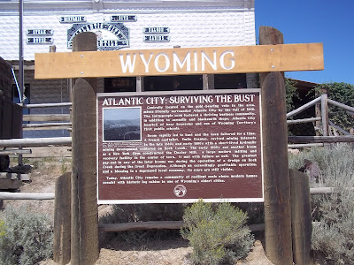
 Atlantic City ????? This isn't Jersey ! Another old mining town.
 We ate lunch at the Merc, the old saloon in Atlantic City .
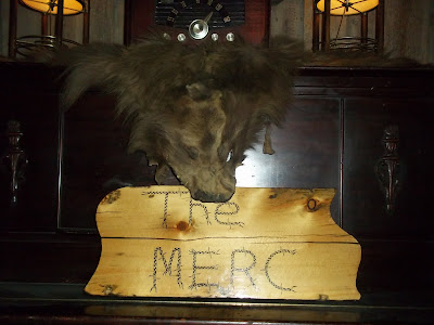
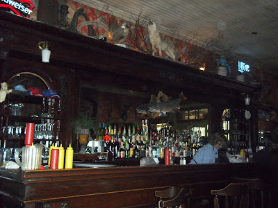 The food was very good. I had a tasty bowl of chili.
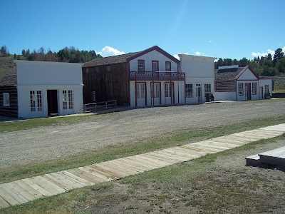
 There were many buildings opened for us to tour in South Pass City. It was quite a town in its day.
 The Carissa Mine at South Pass is where they mined the gold. It kept people coming to this area up to 1949 in hope of making them rich.
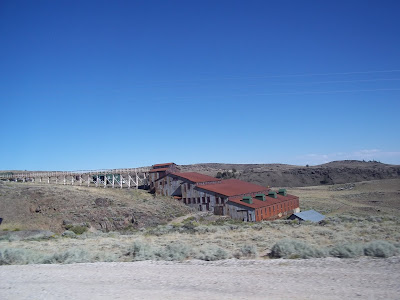
We stopped on our way out of town to look at South Pass where the wagons crossed.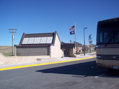
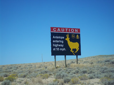
 On our travels to Lyman, WY we saw some very interesting signs along route 28 . Caution slow moving traffic ahead.
 Our next stop on the trail.
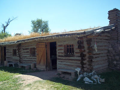
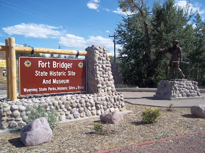 Jim Bridger's built a fort to capitalize on the coming westward migration.
 Rather rustic.
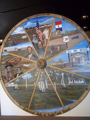
 This area has been a hub of trade and travel. It was used by the Mormans, then became a military post and finally the Lincoln Highway, route 30, went through.
Our group sitting in front of the museum at Fort Bridger.
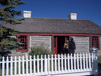
 The log officers quarters.
 Cabins along the Lincoln Highway used some of the building from Fort Bridger.
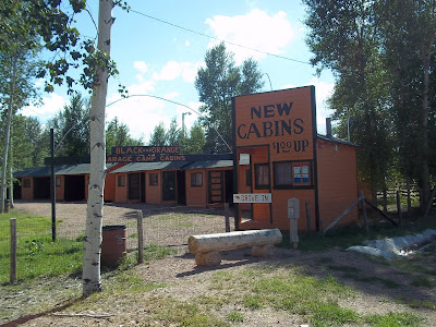
Notice the original Lincoln highway marker.
 2400 markers erected by the Boy Scouts in 1928. I wonder if there were any in Lancaster, PA?
 Handcarts you can pull to Devil Gates, but we didn't choose to do it.
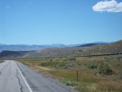
 Mountains ahead, even one with snow.
This is where we stayed on Friday and Saturday. The elevation is now over 5,000 feet.
 South Pass is the area the wagons crossed the Continental Divide, the only place that allowed an easy passage through the Rocky Mountains. We went to South Pass City an old mining town, today it is a ghost town.
 Atlantic City ????? This isn't Jersey ! Another old mining town.
 We ate lunch at the Merc, the old saloon in Atlantic City .
 The food was very good. I had a tasty bowl of chili.
 There were many buildings opened for us to tour in South Pass City. It was quite a town in its day.
 The Carissa Mine at South Pass is where they mined the gold. It kept people coming to this area up to 1949 in hope of making them rich.
We stopped on our way out of town to look at South Pass where the wagons crossed.

 On our travels to Lyman, WY we saw some very interesting signs along route 28 . Caution slow moving traffic ahead.
 Our next stop on the trail.
 Jim Bridger's built a fort to capitalize on the coming westward migration.
 Rather rustic.
 This area has been a hub of trade and travel. It was used by the Mormans, then became a military post and finally the Lincoln Highway, route 30, went through.
Our group sitting in front of the museum at Fort Bridger.
 The log officers quarters.
 Cabins along the Lincoln Highway used some of the building from Fort Bridger.
Notice the original Lincoln highway marker.
 2400 markers erected by the Boy Scouts in 1928. I wonder if there were any in Lancaster, PA?

Thanks for informative and helpful post, obviously in your blog everything is good.
ReplyDeleteWagon Ride Bryce Canyon